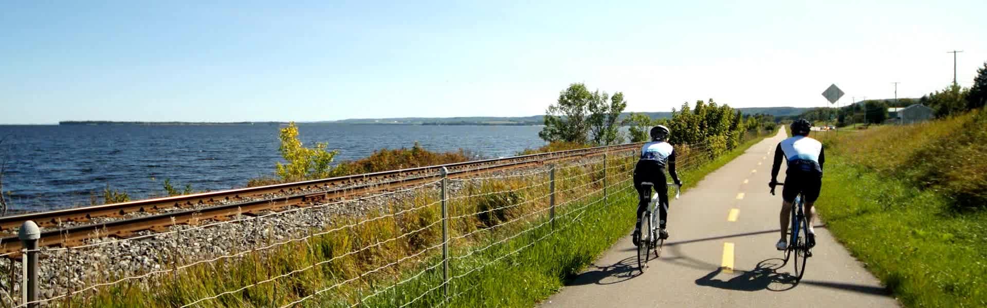
Maps and links to GPS data
Please note that the signage to navigate on the Blueberry Route, the Fjord Route, and the Kénogami Horst is well indicated. Indeed, these three cycling routes are equipped with numerous signs to allow users and tourists to navigate without difficulty.
GPS data
- Half-Tour
- Grand tour 3 days
- 4 Day Tour with Shuttle and hotels
- Grand tour 4 days
- Grand tour 5 days
- Grand tour 5 days Val-Jalbert
- The Tour of Lake Saint-Jean
- The Saguenay—Lac-Saint-Jean
- The Challenge
* The GPS circuit is sometimes not 100% accurate since some sections of the Véloroute are not accessible on the software (too recent or under construction). Please refer to the signs on the Véloroute for directions.
We strongly recommend installing the Ondago application on your mobile phone. This mobile platform for guidance and information allows users to discover tourist places, access interactive maps, and receive real-time information about events and nearby attractions. Furthermore, it provides the option to be geolocated in areas without internet by downloading the appropriate maps.
Detailed maps of each section
- Download maps of the Véloroute des Bleuets, the Fjord and the Horst de Kénogami in PDF or JPG format
Cycling experience guide *
*Please note that we provide 1 Experience Bike Guide for free per 2 persons on the day of your bike departure.

Parking for the duration of the trip
During your bike trip, please use the official parking lot of the Véloroute des Bleuets, located 500 meters from our travel agency.
Club de Curling Riverbend
1030 Rue de la Gare O, Alma, QC G8B 4L8
- From Price Street, go to the corner of Price Street and Desmeules Street.
- Turn right onto Desmeules Street.
- Continue straight until the corner of Desmeules Street and de la Gare Street.
- Turn left onto de la Gare Street.
- The entrance to the parking lot is on the left after the railway tracks.
Parking is not supervised; trailers and motorhomes are accepted.
Please note that you should park facing the railway, as far away from the building as possible.

Alma cycling network: Leaving the city
Overview
- Fully asphalted network;
- Network entirely in cycle path;
- Le Maligneau is a free nautical shuttle (dates and times of operation). * Please note that Le Maligneau sometimes closes without notice because of bad weather conditions;
- Tourist information office and Maison du Vélo accessible by bicycle (question mark sign on the map).

Nature circuit
- For counterclockwise packages only. 🔄
- Distance from Équinox Aventure to Maligneau: 6.7 km (about 25 minutes);
- Distance from Équinox Aventure to the Tourist Information Office: 7.8 km (about 30 minutes);
- Directions:
- Take the bike path and follow the Petite Décharge River until intersection 1 (that's where the adventure begins!):
- Cross Boulevard Melançon, climb the small slope.
- Ride through the forest behind the Quartier résidentiel Saint-Georges until intersection 2.
- Cross Boulevard Des Pins Ouest and the railway.
- Continue through the forest until you reach the Centre de Villégiature la Dam-En-Terre at intersection 3:
- Turn right to enter the Dam-En-Terre site. You will see the entrance to a campground and a beach.
- Continue straight ahead to the marina towards Isle-Maligne.
- Cross the dam and continue straight ahead to Maligneau, where you will cross the river:
- On the other side, climb the hill and turn left towards the Tourist Information Office.
- Take the bike path and follow the Petite Décharge River until intersection 1 (that's where the adventure begins!):
Follow the signs of the Véloroute des Bleuets according to your package.

Circuit in the industrial area
For counterclockwise packages only. 🔄
- Distance from Equinox Adventure parking to the Bridge: 5 km (approximately 15 minutes journey);
- Distance from Equinox Adventure parking to the Tourist Information Office: 7.1 km (approximately 25 minutes journey);
Instructions:
- Take the bike path and follow the Petite Décharge River until intersection 1;
- Cross Boulevard Melançon. There is a short slope to climb. Ride on the bike path through the forest behind the Quartier résidentiel Saint-Georges until intersection 2;
- At intersection 3, do not cross Boulevard Des Pins Ouest. Turn right instead onto the bike path that runs alongside the boulevard. Continue straight until the bridge. Stay on the bike path along the bridge, separated by a concrete wall;
Follow the signs of the Véloroute des Bleuets according to your package.

Half-Tour Circuit

Information about Pointe-Taillon National Park
General Informations
- Unpaved stone dust cycle paths;
- 45 km of cycle paths in total;
- Mandatory entry cost for 18 years old and over in summer except for holders of an annual SÉPAQ card (see prices);
- For cyclists, it is possible to pay the access fee online via a QR code or beforehand on the SÉPAQ website. Also possible to pay on the spot with debit, credit or cash;
- 15 km of beach;
- Boutique Nature at reception 1;
- Snack restaurant near the beach;
- Possibility to rent kayaks, canoes, paddle boards and pedal boats;
- Péribonka - Pointe-Taillon nautical shuttle at a cost of 9,50 $ + txs per adult (dates and times of operation).

Circuit 1 - National Park via the Véloroute des Bleuets
- Recommended itinerary of the Véloroute des Bleuets (kilometrage planned in the itineraries created by Équinox Aventure);
- Due to its affiliation with the Véloroute des Bleuets, this section may be free. You must obtain your free access authorization by calling 418-347-5371, extension 0. Your access will then be sent to you by email;
- 16 km through Pointe-Taillon National Park;

Circuit 2 - National Park, Ferry Crossing to Péribonka
- 20 km from pay point 1 to the ferry;
- Shortened by 10 km on the planned route as in circuit 1;
- The cyclist must pay the cost of access to the park entrance at toll point 1 and also pay the cost of the ferry.

Circuit 3
- 16 km to cross the park from pay point 1 to pay point 2 then 12 km from pay point 2 to the ferry at point 3;
- Extension of 7 km on the route planned as in circuit 1 including the outward journey to Sainte-Monique;
- The cyclist must pay the cost of access to the park entrance at pay point 2 and also pay the cost of the ferry.

Circuit 4 - Full Tour of the National Park
- 44 km through the Pointe-Taillon Nation Park;
- Extension of 29 km on the planned route as in circuit 1;

Web resources for planning your trip
Have questions? Check out our FAQ


 Bienvenue sur Équinox ! Nous utilisons des cookies